How Qomolangma rose to new heights


Difficult task
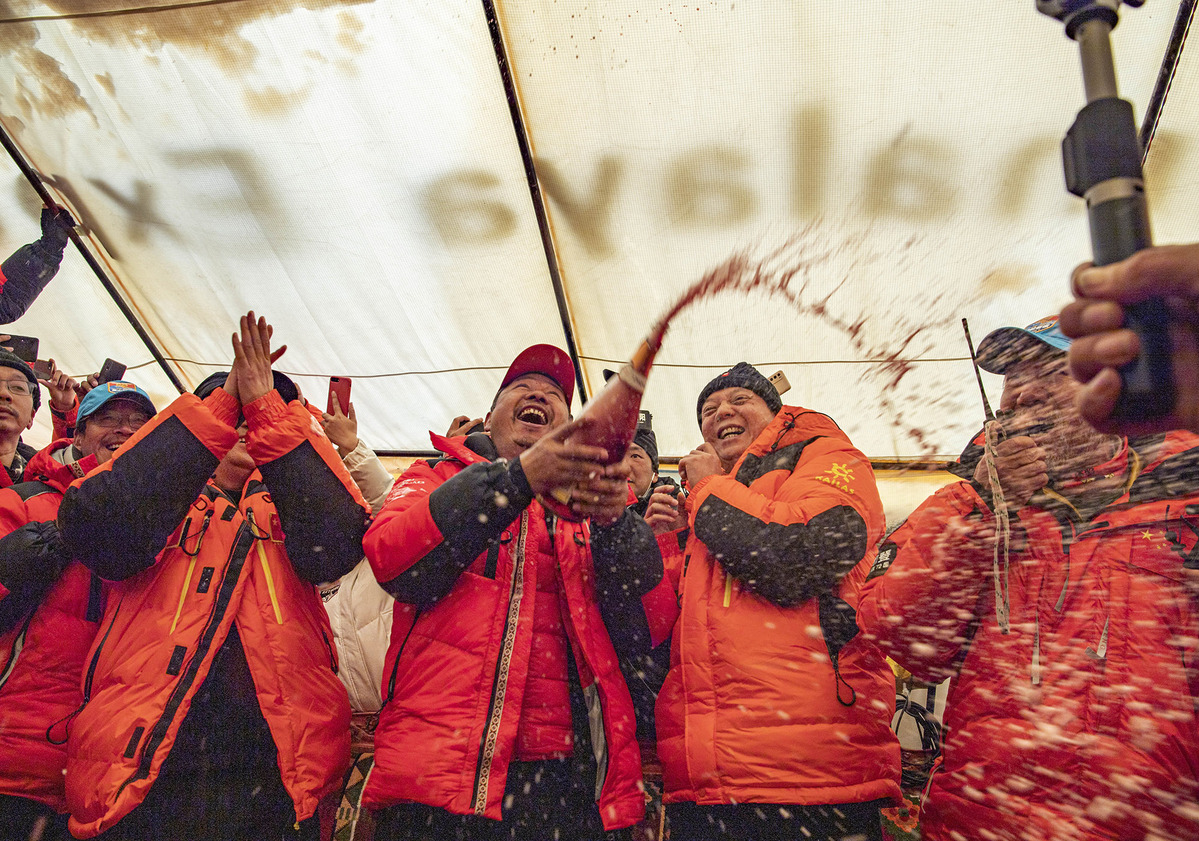
In May last year, a Nepalese surveying team reached the summit of Qomolangma to carry out measuring work.
This mission proved difficult, with a surveyor carrying a global positioning device and radar system to the summit losing the tip of a toe to frostbite, according to The Washington Post. The team also faced a shortage of oxygen on the descent.
After the teams from China and Nepal reached the summit, technicians from both nations carried out data processing work before agreeing on the mountain's new height.
Nepal had previously adopted an estimate of 8,848 meters made by India for the height in 1954, while China measured it at 8,844.43 meters in 2005. The difference in the two figures takes into account the snow cap.
Another problem was that China used the Yellow Sea as a sea-level base for the peak, but Nepal used the Indian Ocean.
Jiang Tao, associate researcher at the Chinese Academy of Surveying and Mapping, told Global Times: "In international cooperation, it is not appropriate to use either elevation benchmark. In line with international practice, we finally decided to use the parameters of the alternative Global Geodetic Observing System endorsed by the International Association of Geodesy."
Geodesy is the branch of mathematics dealing with the shape of the Earth or large portions of it.
Jiang said that after it was agreed to use the world standard, work progressed smoothly.
Santa Bir Lama, president of the Nepal Mountaineering Association, told USA Today, "This is a milestone in mountaineering history that will finally end debate over the height."
Buddhi Narayan Shrestha, former director-general of the Department of Survey Nepal, who acted as a senior adviser for the measuring project, told The Washington Post calculations by both countries had "synchronized sufficiently" to enable agreement on the new height.
"It couldn't have been more accurate than this," he added.
Rajiv Kumar Jha, a Nepalese professor at Xi'an Medical University in Shaanxi province, who has been visiting China for more than 20 years, said the relationship between the two countries "will rise across the Himalayas and reach a new height of over 8,848 meters".
The 41-year-old believes the announcement points to warming Sino-Nepalese ties against a backdrop of increasingly complex international relations and rising unilateralism during the pandemic.
Scientific exploration always comes with errors, but these can be minimized by international collaboration, he added.
Despite appearing to stand on extremely firm foundations, even Qomolangma shifts with time and tectonics-major events affecting the structure of the Earth's crust.
In 2015, a major earthquake struck the mountain and surrounding area, killing at least 8,700 people, damaging about 1 million structures in Nepal and triggering an avalanche on Qomolangma that claimed 19 lives at base camp.
The tragedy also triggered debate over the mountain's height and concern that it may have shrunk.
Over the years, a number of heights have been allocated to Qomolangma. Measuring the mountain can be traced to the mid-19th century, when a survey team from India put its height at 8,840.07 meters. Since then, many countries have submitted their own measurements.
In 1975, Chinese surveyors determined the height to be 8,848.13 meters, while 30 years later, a team from the country scaled the mountain and amended the height to 8,844.43 meters.
The measuring work carried out on Qomolangma this year, which also assessed snow depth, weather conditions and wind speed, will help glacier monitoring and environmental protection work.
First scaled in 1953, Qomolangma has become a target for international climbers, with hundreds arriving on its slopes in spring every year.
However, they leave behind a vast amount of rubbish and human waste, which has resulted in the mountain being tagged "the world's highest garbage dump".