Yearender-China Focus: China builds integrated, intelligent monitoring network to safeguard biodiversity


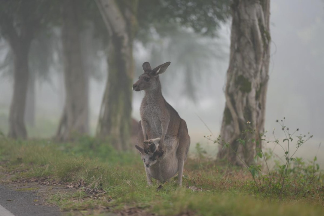
BEIJING -- A decade ago, biodiversity monitoring often required researchers to haul heavy equipment across rugged mountains and vast grasslands. Today, a quiet revolution is unfolding as satellites scan from orbit, sensors perch atop towers, drones skim treetops and mobile laboratories traverse the ground.
This multi-tiered technological collaboration is transforming the way China monitors and protects its biodiversity.
"Previously, surveys were predominantly manual, limited in scope, slow and labor-intensive," said Wu Jiyou, director of the Satellite Application Center for Ecology and Environment (SACEE) of the Ministry of Ecology and Environment. "Now, our 'Five Platforms System' integrates satellites, drones, towers, mobile patrols and ground stations. It covers larger areas, operates more efficiently, and is sustainable."
VIEW FROM ABOVE
At the core of this shift is remote sensing, which enables data collection without direct physical contact.
Wan Huawei, a specialist at the SACEE, has not only witnessed this paradigm shift but also played an active role in advancing it. More than a decade ago, her team addressed reports concerning the spread of the invasive plant Spartina alterniflora in southern China. By leveraging satellite imagery and drone technology, they mapped its expansion patterns, providing evidence that helped guide control efforts.
Later, in collaboration with ecologists from Peking University, SACEE applied analogous methodologies to snow leopard conservation efforts. By integrating satellite data on terrain and human activity with confirmed sightings, researchers identified key habitats and assessed their connectivity, facilitating the development of wildlife corridors.
"China's Gaofen satellite series now delivers more frequent and higher-resolution data than ever before," Wan said. "New tools, such as hyperspectral imagery and lidar, have further enhanced our capabilities."
"By integrating space-, air- and ground-based data, ranging from infrared cameras to high-resolution imagery, we can monitor biodiversity across multiple scales, from individual species to entire ecosystems," she added.
BIODIVERSITY DATABASE
On the grasslands of North China's Inner Mongolia autonomous region, Wang Yongcai, an engineer, and his colleagues are constructing what they describe as one of China's most comprehensive grassland biodiversity databases. Each summer, Wang spends about six weeks in the field documenting grass species, pasture growth and ecosystem health.
"It's demanding work, but we believe it's extremely meaningful," Wang said, his skin tanned from long hours spent outdoors.
The goal is to achieve dynamic monitoring of pasture growth, vegetation coverage and grassland degradation, including desertification and salinization, enabling more precise assessments of grassland conditions over time.
So far, SACEE has amassed extensive datasets and established a preliminary digital platform, with an intelligent grass species identification system and a grassland parameter inversion system already operational.
"In pilot areas of Inner Mongolia, plant species identification accuracy has exceeded 80 percent," Wang said.
Given that data volume directly impacts database quality and identification accuracy, the SACEE plans to construct unmanned aerial vehicle airports in pilot regions. Once completed, drones could be remotely operated from Beijing, significantly enhancing monitoring capacity, Wang added.
SMART TOOLS
Technological advances have also reshaped fieldwork. Bulky equipment once shipped to remote locations has been replaced by portable, high-efficiency instruments, improving productivity and safety.
Parked outside the SACEE is what appears to be a standard off-road vehicle, but in fact, it is a multifunctional ecological mobile patrol unit. Since its completion in August 2022, it has undergone continuous upgrades. Equipped with self-developed multimodal animal recognition models, it can automatically identify, count and track wildlife populations. The system has been tested in Beijing, Inner Mongolia, Northwest China's Qinghai province and East China's Shandong province.
On the Inner Mongolia grasslands, a four-legged robotic "dog" is also assisting with plant diversity surveys. Controlled remotely, the camera-equipped machine can navigate autonomously, photograph vegetation and transmit images in real time, greatly improving efficiency. Developed by the SACEE, the mobile grassland biodiversity monitoring platform carries a 360-degree visible-light camera and can identify key species, including invasive plants and rare or endangered flora, using high-definition imagery.
Gao Jixi, chief scientist at SACEE, stressed that the "Five Bases System" represents far more than a mere aggregation of monitoring tools. "It is a sophisticated, multidimensional network engineered specifically for ecological remote sensing needs. The system integrates equipment, data and applications, linking every phase of the monitoring process. Realizing this vision demands extensive collaboration and the seamless integration of biodiversity data across diverse regions and administrative levels."
"New concepts and technologies are fundamentally transforming biodiversity monitoring," he said. "Through sustained efforts, we aspire to further enhance our monitoring capabilities and contribute to the implementation of the Kunming-Montreal Global Biodiversity Framework."


- China builds integrated, intelligent monitoring network to safeguard biodiversity
- China sees marked rise in 5-year survival rate for pediatric, adolescent cancers
- 'Homecoming Across the Seas': A song bridging homeland and the world
- 8 dead in fatal Jiangxi car accident
- Xinjiang to introduce football classes across all schools
- Lai Ching-te criticized for selling out Taiwan's competitive industries